Tag Archives: historic architecture

Belgian Blocks, Portland’s Historic Streetscapes

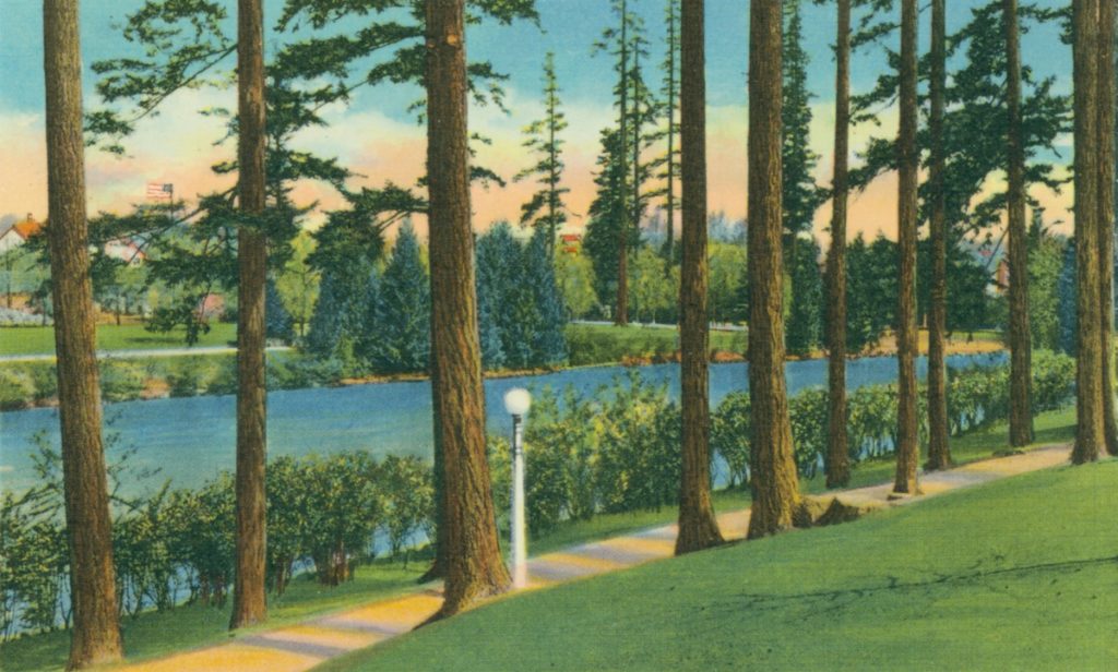
Portland’s historic streetscapes were composed of Belgian Blocks, more commonly referred to as cobblestones. From 1885 to the 1900s, the City of Portland used Belgian Blocks as the primary paving surface, bridging the gap between mud roads and asphalt pavement. When asphalt replaced the blocks as the primary road surface, the asphalt was applied directly over the blocks essentially hiding the blocks from the public domain. During street repair projects, the Belgian Blocks are often rediscovered under the asphalt. Per city ordinance, when blocks are exhumed, they are stockpiled for potential future redeployment.

City-PDX-archive-PDX-1928

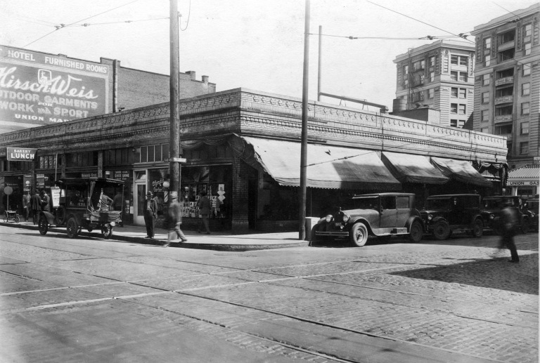
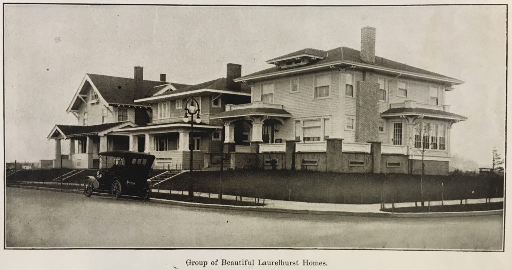
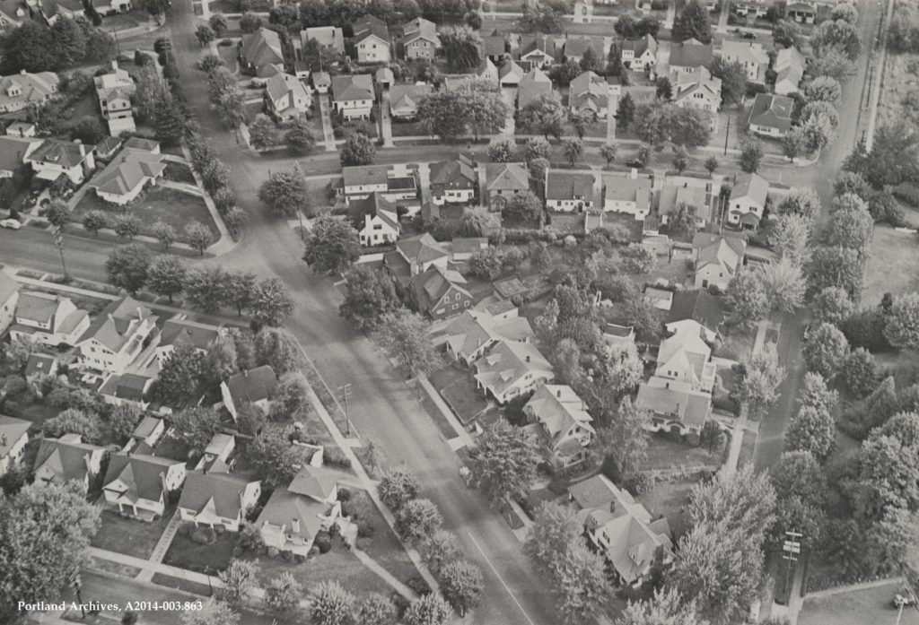
Belgian Block streetscape in Portland, Oregon, 1928.


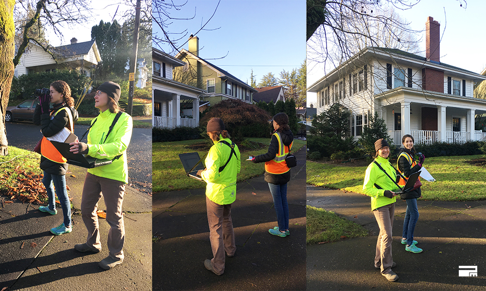
To better understand how the City of Portland might redeploy the existing Belgian Blocks, we completed a research report on the Belgian Blocks for the Bureau of Planning and Sustainability, and facilitated two listening sessions with the Portland Historic Landmarks Commission to gather perspective. The report provides the Portland Historic Landmarks Commission (PHLC) and the Portland Bureau of Transportation (PBOT) with background information and technical data for consideration of how best the city might utilize the redeployment of its Belgian Blocks.

UNDERSTANDING STONE PETROGRAPHY
Background information on stone petrography is necessary to understand durability, chemical composition, and other factors affecting use of stone in the built environment. When it comes to stone found across the Pacific Northwest, when in doubt, guess basalt. The two quarries that the Belgian Blocks of Portland originate from are the St. Helens and Ridgefield quarries, located in the Columbia Plateau Region.

Ridgefield Quarry

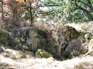
Ridgefield Quarry, 2011.


In 1931, Harold Fisk produced a history and petrography of Oregon basalts, providing microscopic imaging of different basalts. The work that Fisk did resulted in a comprehensive analysis and categorization of basalt types in Oregon, meaning that comparable basalt types and the locations in Oregon can easily be found and used.[i]

NEOLITE AND LEATHERED
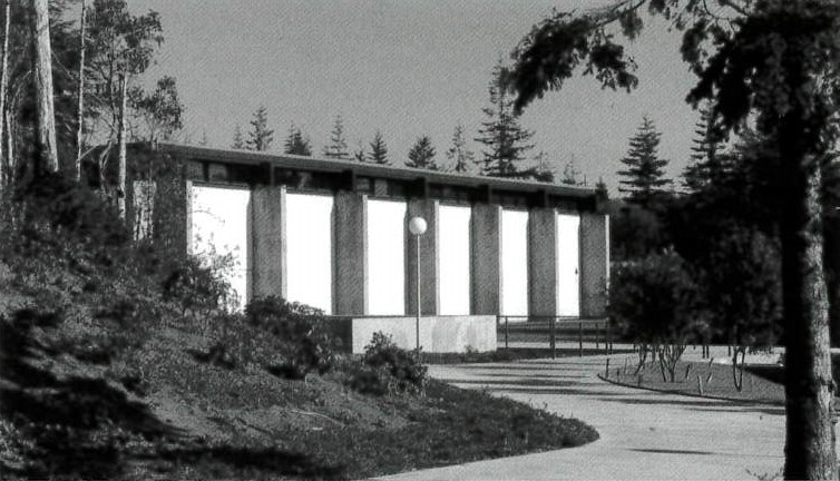
An US Geological survey from 1976 compared the Columbia Plateau basalt flows to the Oregon and Washington coastal basalt flows, giving specific chemical composition of the samples taken.[ii] To further identify the Belgian Block’s thru petrographic differences, a report from 1983 tests the characteristics of two different types of stone blocks at Lewis and Clark college. The types are referred to as “Neolite” and “Leathered,” the latter a common name that may have been derived by the supplier of the stone at the time of installation.

belgian blocks lewis and clark college

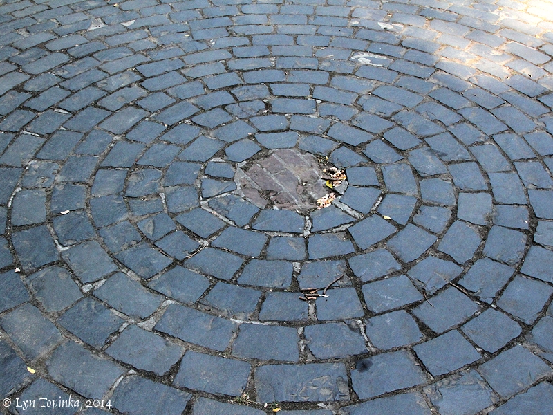
Belgian Blocks at Lewis and Clark College. Lyn Topkina, 2014.


REDEPLOYMENT OF BELGIAN BLOCKS
During the 1970s, with renewed interest in saving Portland’s historic character, the City of Portland passed ordinances no. 139670 and no. 141548 in 1975 providing guidance for redeployment of Belgian Blocks removed during street repair projects. At the time of adoption, these ordinances were primarily focused on salvaging characteristics of Portland’s original street scape. As a result, the ordinances did not address the practical aspects of re-deployment and could not anticipate the Americans with Disability Act (ADA) requirements mandating accessibility for all citizens.

Re-deployment of Belgian Blocks within the public right-of-way must meet modern building and land use codes like ADA and historic review. As a part of any re-deployment of Belgian blocks in public spaces, understanding how the blocks meet, or could be modified to meet, current accessibility codes are critical. Specifically related to the use as walking and biking surfaces, two primary concerns arise: tripping and slipping.

belgian block

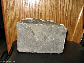
Belgian Block, Lyn Topinka, 2014.


Our report demonstrates that it is possible through manipulation of the stone surface, use of setting means and methods, and testing, to modify the Belgian Blocks to allow for reuse as horizontal surfaces. Modifying the physical characteristics of the blocks to meet tripping and slipping standards for re-deployment is possible. Many modification techniques exist for both shop and field modifications. The report focuses on two: cutting and dressing surfaces.

NEXT STEPS
In review of the primary issues raised regarding resistance to redeployment of the Belgian Blocks, the research performed and presented in the Belgian Block Report provide data and ideas by which both the PHLC and PBOT are able to reconsider polices and from which more alignment with similar goals for redeployment may be met. Our recommendations include:
1. The historic ordinances need to be updated to reflect more deployment options;
2. Design details for deployment are in need of updating and reflect various methodologies;
3. Provide objective criteria for linear deployment of Belgian Blocks within the Public Right of Way;
4. Provide clarity that streetcar and light rail stops are to use Belgian Block in linear patterns;
5. Allow modification of the block surfaces to increase slip resistance and promote textural variations.

Read the full: Belgian Block Report

[i] Harold Fisk, “The History and Petrography of the Basalts of Oregon,” Masters of Art and Science Diss. (1931), University of Oregon, Eugene, OR. University of Oregon Library, 461. F57.
[ii] Allan B. Griggs, and Donald A. Swanson, The Columbia River Basalt Group in the Spokane Quadrangle Washington, Idaho, and Montana, with a Section on Petrography, Geological Survey Bulletin 1413, US Geological Survey (1976).

Understanding the Veracity of In-Situ Data Acquisition on Historic Buildings

Many historic preservation, restoration, renovation, and/or adaptive reuse projects require the analysis of existing building materials. This could be to meet demands for repair treatments, ensure energy performance targets, or research the history and authenticity of a building or site (amongst many others). Projects often call for advanced analytic techniques such as infrared thermography, RILEM tube water absorption, acid-dissolution of mortar, petrography, x-ray diffraction, and a plethora of other scientific tests to ensure a proper understanding of the chemical and physical properties of the existing building materials. These tests are often costly and time-consuming. For these reasons, many projects rely on results from a single test, or a small handful of tests. This begs the question, are the results from a few analytical or forensic tests representative of the entire building (either in its performance or historical characteristics)?
QAHSC-south-wall-pmapdx
HISTORIC BUILDING MATERIAL PROPERTIES
Historic buildings present unique challenges. Unlike modern construction, historic buildings were built in a time without the same levels of standardization and mass-production that we see today. Home Depot was not a thing yet, and in its place, contractors were reliant on local hardware stores or local/regional distribution sources for building materials. In many cases, they made their own! As a result, when analyzing historic buildings today, the material properties are generally unknown and undocumented.

TIME AND THE ELEMENTS
Adding to the unknown is the process of time. Mother nature and the elements are a continuous impact – weathering historic buildings and changing the chemical and physical nature of extant materials. Different parts of a building will also weather at different rates, depending on several variables such as orientation, exposure, occupation, micro-climates, site and neighboring elements, water migration, and so on. There is also a good chance that over the years many repairs have been made, creating a patchwork of different materials. This creates buildings with highly varying characteristics and performance when measured in-situ.


Written by Daniel Castele, Designer and Conservator.

In-Situ R-Value of Old Buildings

pmapdx-building-exterior
Architects are becoming ever more aware of their impact on the environment. The building sector is estimated to be responsible for 36% of worldwide energy use, and is responsible for 39% of energy-related carbon dioxide emissions.(1) Carbon emissions, embodied carbon, & life cycle assessments are now being studied like never before, and are becoming part of the architect’s daily lexicon. One side of this coin is research into building envelopes, insulation, and thermal resistance of building materials.

While contemporary building materials are produced under standardized, industrial manufacturing processes, and therefore have known thermal profiles; historic buildings are rather unique, with materials of unknown and inhomogeneous thermal characteristics. This presents architects and energy modelers with some uncertainty when making decisions related to insulating historic envelopes. With contradicting claims amongst professionals – some say historic exterior walls are energy hogs, while others purport many historic envelopes performing at or better than previously believed – the question that remains is, how well are historic envelopes resisting lateral heat flow?
In-Situ R-Value Blog
R=I/λ OF OLD BUILDINGS
As part of ongoing research, PMA is taking it upon themselves to study and better understand this phenomenon. The set-up in the image above is a Fluxteq R-value Measurement Kit. It is capable of measuring the r-value of building envelopes in-situ. A thermocouple and surface temperature sensor are affixed to the interior face of the historic concrete envelope, and one surface temperature sensor is mounted to the exterior of the envelope, directly opposite the interior sensor. Our testing will conduct both spot R-value measurements and long duration tests, so we can get an understand how the R-value fluctuates throughout the day and in response to external climate conditions.

This research is supported by PMA’s new initiative towards net zero historic buildings and sustainability.

For inquiries related to this research please contact: danc@pmapdx.com


1. https://www.worldgbc.org/sites/default/files/UNEP%20188_GABC_en%20%28web%29.pdf
Written by Daniel Castele, Designer and Conservator.

fountain-place-apt-pmapdx-home-forward-rendering

Fountain Place Apartments Seismic Renovation

Constructed in two distinct phases in 1911, the Fountain Place Apartments were originally named the Wheeldon Annex. The building occupies a quarter-block lot in downtown Portland, Oregon, at the corner of SW Salmon Street and SW 10th Avenue. Fountain Place is one of the earliest surviving examples of a U-shaped residential apartment/hotel in downtown Portland. It is a 5-story brick structure with intact Italian Renaissance Revival features such as a decorative bracketed cornice, buff brick body with corbeled details and rusticated base, and an upper level treated as a paneled frieze. The property is owned by Home Forward. There are 80 total units, with studio, one and two bedroom homes. The residents it serves have incomes of 30% of the area median income.

Working with Lorentz Bruun Construction, we are delivering a design-build project to improve the life safety of Fountain Place Apartments, while retaining its historic character. To learn about how the redevelopment of Fountain Place Apartments revives a historic building by providing critical infrastructure for current residents and new arrivals, please visit: Fountain Place Apartments PDX

Condensation Analysis for Historic Window Replacements

Window alterations for original single pane glass or new insulated glazing units with new interior storm windows, are growing requests from building owners of historic commercial properties. Two items we recommend to consider regarding these types of alterations: the potential for condensation as a result of the alterations, and the required review processes that may be triggered by exterior alterations to the historic building. In addition, installing a mock-up of proposed window alterations provides the opportunity to accurately measure and document existing and proposed conditions, and review the location of sealant joints and proposed glass types in order to accurately simulate the risk of condensation.

CONDENSATION ANALYSIS
Installation of new storm windows typically reduces the potential for condensation at the interior face of the glass as the surface is kept warmer. However, interior storms can lead to condensation within the interstitial space between the existing window and the new storm window. The condensation is a result of the warm humid air inside the building leaking into the colder interstitial space. As air leaks into the interstitial space, it cools and it can condense on the interior surface of the exterior glazing unit. Moisture/condensation within the interstitial space can cause deterioration of the wood surfaces and obscure views to the exterior.

For this type of condensation analysis, PMA uses THERM, a tool for modeling 2-dimensional heat transfer and WINDOW, a tool for calculating window performance to analyze the windows. The purpose is to understand how the addition of storm windows will impact heat transfer and window performance in order to gauge the potential for condensation. The focus of this type of simulation is determining if the temperature of the air within the interstitial space would reach its dewpoint – indicating water would condense. Following the analysis results, PMA provides recommendations for mitigating and minimizing condensation based on the condensation simulations.
condensation-analysis-historic-window-replacement
LIMITATIONS
It should be noted that no single tool exists for modeling all of the variables associated with moisture and heat transfer through windows. Hygrothermal analysis (transfer of heat and moisture), is typically limited to 1-dimensional simulation which is inadequate for the complexities of a window which has wood, air, glass, sealant, etc. The 2-dimensional software that has been verified is not currently capable of simulating the complexities associated with heat transfer/soar heat gain through glass surfaces and air. The software we use for window analysis studies is designed to provide the following information:

U-Values
Solar Heat Gain Coefficient (SHGC)
Condensation Resistance Index
Surface Temperature Map of the Entire Window
2-Dimensional Heat Transfer

Additionally, the potential for condensation is directly related to air temperature and relative humidity. Depending on the use of the commercial building, the interior air temperature and relative humidity are expected to vary greatly. The simulations performed as part of this study cannot account for all of the potential temperature/relative humidity variations that may occur. The results may vary depending on different interior/exterior conditions.
condensation-analysis-historic-window-replacement
MODEL SET UP
For this type of analysis we develop cross-section drawings for the window head, sill, upper jamb, lower jamb, and meeting rail. The sections are developed based on field measurements (note, sometimes we only have access to interior measurements, making exterior ones approximate). The sections are imported into THERM and modeled to simulate heat flow through the window. We then select glazing systems from the extensive glass library. The systems are selected to match the properties of the proposed materials as closely as possible.

Simulations are set up to run according to the National Fenestration Rating Council (NFRC) standards which specify conditions for simulating the interior and exterior environments. The required exterior temperature is at 0 °F and the interior at 70 °F. These temperatures provide information on more severe conditions than Portland, Oregon, however, they can be used to conservatively predict when condensation is possible. Once the cross sections has been modeled and simulated in THERM, the results are imported into WINDOW to calculate the full window performance, including SHGC, Condensation Resistance Index, U-Value, and temperature Map.
condensation-analysis-historic-window-replacement
CONCLUSION
While simulations cannot definitively predict the location and quantity of condensation, the results can be interpreted to predict the probability of condensation occurring. Sometimes our analysis shows the possibility that water will condense within the interstitial space, which happens primarily for the following reasons:

The air temperature within the interstitial space is significantly colder than the room air temperature. Any water within air infiltrating into this space may condense under the right conditions. This is exacerbated by the fact that the room temperature and relative humidity may vary greatly and cannot be strictly controlled.

The simulation for predicting condensation on the interior face of the IGU indicated that condensation was possible when the air within the interstitial space matched the properties of the interior air. Under actual conditions, the air within the interstitial space will likely be cooler and more humid than the interior air. The cooler, wetter air will have an even greater potential for condensation.

Condensation within the interstitial space between an existing and storm window is common and several methods are available to reduce the potential for condensation and mitigate any water within the cavity. For clients we provide recommendations with our analysis of window alterations for original single pane glass.

Written by Halla Hoffer, AIA, Assoc. DBIA

pioneer-courthouse-portland

Pioneer Courthouse Seismic and Historic Renovation

As the second oldest federal building on the west coast and the third highest ranked historic structure in the General Service Administration’s portfolio, Pioneer Courthouse is a significant historic sandstone structure. Peter Meijer Architect, PC (PMA) acted as the Preservation Conservator hired directly by the General Service Administration to consult the construction team engaged in the base isolation seismic upgrade and historic renovation of the circa 1875 Pioneer Courthouse. PMA revised the means and methods associated with the preservation specifications, represented the Owner, and provided CA services on issues affecting the historic property.

AWARDS & RECOGNITION
Preservation in Action Award Pinnacle Award
Architectural Heritage Center/Bosco-Milligan Foundation, 2008

Craftsmanship Award
AIA Portland Chapter, 2006

Top Project
Daily Journal of Commerce (DJC Oregon), 2005

Surveying the Laurelhurst Neighborhood in Portland, OR

Founded in 1912 on the original plat of William Ladd’s Hazel Fern Farm, Laurelhurst was developed to be an example of the potential for European “garden suburbs” close to the city. An eclectic variety of architectural styles, from “fairyland” bungalows to quaint English cottages to the more classic Dutch Colonials, was chosen as a set of prototype designs for the creation of this community-centered neighborhood. To this day, many of these homes still exist, as does the pre-intended sense of comradery between its residents.
pmapdx-laurelhurst-survey-portland-oregon
WHAT IS THE LAURELHURST SURVEY PROJECT?
Peter Meijer Architect, PC (PMA) is in the process of conducting a Reconnaissance Level Survey (RLS) of the Laurelhurst neighborhood in Portland, Oregon. Data from the survey will be used to prepare a potential historic district nomination of the neighborhood. A great deal of research was necessary to understand Laurelhurst’s general historical context prior to beginning survey fieldwork involved in the RLS. We began by reviewing all previous documentation that has been collected of the neighborhood—including historic tax records, Sanborn maps and other graphic data, newspaper articles from historic periodicals, and the City of Portland’s Historic Resource Inventory. We also reviewed context statements that had been written for earlier historic district nomination efforts, and primary source documents that had recorded Laurelhurst during its early stages of development.

The primary objective of a Reconnaissance Level Survey (RLS) is to provide a “first cut” of typically residential resources within a given area that appear to meet the survey criteria for historic significance. An RLS involves only a visual evaluation of properties in relation to the overall neighborhood context, not an assessment of associated historical events or individuals connected to the property.
pmapdx-laurelhurst-survey-portland-oregon
With the information gathered from our preliminary research at hand, PMA set out in November 2017 to survey approximately 1800 properties that were constructed during Laurelhurst’s period of significance. Our approach will be informed by information gathered during our research and any additional background information provided by Laurelhurst residents’ initial observations. Factors includ¬ing potential eligibility, typographical distribution of resources, integrity of setting, and proximity to other resources will be considered when selecting survey properties.

So far, we have completed 70 percent of the total survey area. As Laurelhurst consists of approximately 1,800 properties, we still have a large number of houses to go!

There are distinct characteristics within Laurelhurst that are well known to residents and visitors. The inclusion and extent of these characteristics, like street patterns, open spaces, landscapes and trees, objects like sculpture, lamp posts, etc. will be discussed with the LNA, the City, and the State Historic Preservation Office (SHPO) to determine the importance of the characteristics in telling the story of Laurelhurst.
pmapdx-laurelhurst-survey-portland-oregon
SURVEY PROCESS TO DATE
PMA project staff has been working with a taskforce of volunteers—residents of the Laurelhurst neighborhood and preservation graduate students from the University of Oregon. To date we have finished surveying three of five sections of the neighborhood. The in-field survey will be completed by late Spring 2018. Some properties have been noted as potential opportunities for an Intensive Level Survey (ILS), in which a more detailed review of the property would yield further information of its level of historic integrity and the significance of Laurelhurst as a whole. Intensive Level Surveys, if any, will also be completed by late Spring 2018. PMA aims to have a first-draft nomination ready for the Laurelhurst Neighborhood Association by June 2018.
pmapdx-laurelhurst-survey-portland-oregon
Challenges
The main challenge has been the large size of the survey area, the fact that we have a limited number of staff and volunteers, and walking around all day. The weather has also been difficult at times—with very cold temperatures, rain and snowfall. Dry days at this time of the year are hard to come by, but they are ideal because many leaves have fallen from the trees that block visibility of the houses and lighting is always better on a gray day.

Community Interaction
Many residents of the area have already conducted their own research on the history of their houses, and many have shared with us their findings. Of the stories we have received, we learned of a cluster of houses owned by many generations of the same family, one woman who met the famous architect that designed her house, and a man who has nurtured a dilapidated house back to life. We encourage anyone who may have more information about the history of development in Laurelhurst to contact us as well.

Interesting Resources
We have collected a number of historic photographs of Laurelhurst homes from multiple sources, including a 1916 Brochure of “Laurelhurst and its Park”, and have had a lot of fun tracking them down. Some have been demolished, but there are still MANY that exist.
pmapdx-laurelhurst-survey-portland-oregon

Written By Marion Rosas / Designer

The Historic Documentation of Umpqua Hall

Southwestern Oregon Community College hired Peter Meijer Architect in September 2017 to assist in the historic documentation of Umpqua Hall. This significant resource will be reconstructed as part of the college’s new Health and Science Technology Building, a project that will provide additional classroom space to support the college’s nursing and EMT programs. Umpqua Hall played a significant role as one of the first two buildings constructed on campus to serve as the primary location for the college’s vocational courses. Below is an excerpt from the documentation that PMA provided for the State Historic Preservation Office that assesses the historic significance of Umpqua Hall.

1972 ca._Umpqua Hall
HISTORY AND CONTEXT
Southwestern Oregon Community College was the first post-secondary education available to students on the Oregon Coast in the early 1960’s. It held its first classes in 1961 at the North Bend airport, and was relocated to its new home three years later. Prior to its establishment, students in this coastal area travelled long distances to be able to attend college, and many could not afford to go at all.

Southwestern Oregon Community College began as a vocational school with the mission of preparing the general population of Coos Bay to enter a workforce created mainly by the timber and fishing industries in the area. As the original “Shops Building”, Umpqua Hall was at the heart of this development. It was the primary building on campus to house many of the school’s vocational-technical programs. The automotive, welding, and carpentry shop classes that were a part of the Mechanics and Industrial program all took place in Umpqua Hall.

In the 1970’s, the college faced the dilemma of a changing market in Coos Bay. As housing development increased in the city and brought the opportunity for new businesses with it, minimum wage service-oriented jobs began to replace the higher paying manufacturing jobs that the college’s courses were tailored toward. Graduates of the programs offered at SWOCC were in less demand, and student enrollment began to decrease. As a result, SWOCC recognized a need to provide displaced workers—as well as veterans that were returning home from the Vietnam War and students seeking to later transfer to a university at an affordable cost—with the appropriate type of education required to compete in the changing economy.

The campus has since evolved to accommodate these economic changes. Umpqua Hall was retired from its academic function when the Automotive Technology program was eventually eliminated in 1994. The oldest buildings that still exist at SWOCC, namely Umpqua and Randolph Halls, represent a significant period of economic growth in the history of Coos Bay that played an indispensable role in the initial development of the city and in its educational options.

1964_Aerial view SWOCC with Randolph and Umpqua Halls only
UMPQUA HALL CONSTRUCTION TIMELINE
1963 to 1964—Umpqua and Randolph Halls, as well as parking lot #1 on the south side of campus, were constructed as part of Phase I of the 1963 six-phase Master Plan. Randolph Hall was known as the “Laboratory Building” that served as the main academic building. Umpqua Hall was known as the “Shops Building”, and originally functioned for vocational schooling that included automotive, carpentry, woodworking, and industrial technology classes.

1964 to Mid-1960’s—The campus underwent Phase II of the Master Plan that included Dellwood Hall (the administration building and temporary home of the library at the time), Coaledo Hall, Sitkum Hall, and parking lot #2.

1981—A storage outbuilding was built to the west of Umpqua Hall by this time, probably in the late 1970’s.

Circa 1985—The college planned to relocate the “Industrial Building” to a location northeast of Prosper Hall, but to keep the metal welding and auto diesel programs located in Umpqua Hall. The plan was to eventually phase out the use of Umpqua Hall.

1994—The Automotive Technology program in Umpqua Hall was eliminated, and the building was retired from academic purposes.

1994 to 1999—By this time, new buildings had been constructed northeast of Prosper Hall to accommodate for the retirement of Umpqua Hall. Fairview Hall held the new welding and manufacturing classrooms, and the new Lampa Hall housed what became known as the B-2 Technology Annex.

2005—Umpqua Hall had since been used for an assortment of different functions. At this point, the building served as the college’s computer networking and hardware instructional labs. As early as 2005, a Master Facility Plan mentioned that a design for a Health, Science, and Technology building was being considered, which would have resulted in the conversion of Umpqua Hall to additional campus storage and maintenance space for the Plant Operations department.

2008—As part of a potential $2,600,000 project to reintegrate Umpqua Hall, another Master Plan of the SWOCC campus proposed to rehabilitate the building to serve as the electronic lab and to hold AutoCAD and computer classes for students. This plan also proposed to add a Student Center Addition to the western side of Umpqua Hall. This proposal was not actualized.

2017—Currently, Umpqua Hall is used for campus security operations and storage, and its western outbuilding serves as an auxiliary maintenance warehouse for Plant Operations. A new project to incorporate Umpqua Hall into the new Health, Science, and Technology building is underway.
southwestern-oregon-community-college-most-beautiful-campuses-1024x608
AT A GLANCE – PROPOSED PROJECT FOR UMPQUA HALL
The most substantial work proposed at the SWOCC campus is the reconstruction of and addition to Umpqua Hall, one of the college’s two oldest buildings, to develop the new Health & Science Technology Building (View 10). The outbuilding that sits west of Umpqua Hall will be demolished to make way for the construction of the new “west wing” addition. Both the interior and exterior of Umpqua Hall will be heavily altered to provide space for the program’s health and science classrooms and offices. A new “west wing” addition will also be built southwest of the Umpqua Building, and will more than quadruple the overall square footage of the new facility. The eastern end of the addition will intersect with the southern end of the existing building at a 90-degree angle. A large lecture hall will protrude from the northern façade of the addition.

Written by Kristen Minor / Associate, Preservation Planner with Marion Rosas / Designer

Assessing a Historic House in Springfield, Oregon

Owning, maintaining, and providing active use within a single family settlement era house is not a typical mission for a public parks agency. One such property is the Reynold & Eva Briggs House located in the northeast corner of the Dorris Ranch Living History Farm, in Springfield, Oregon, currently stewarded by Willamalane Parks and Recreation District (WPRD). Compounding the unusual situation is that the area is a historic site, a working farm, and a public park. In addition the property’s history, age, material, and conditions of the house add further complexity to the stewardship role. In order to guide the WPRD with long-range decisions regarding the Briggs House, the District sought an up to date exterior and interior condition assessment and potential rehabilitation options in support of current and future park programming needs, including as a source of income derived from continued residential use. The Briggs House has not been occupied since its last resident left in 2009.
Briggs-House

THE ASSESSMENT
The property, The Dorris Ranch Living History Farm, was listed as a National Register of Historic Places Historic District on June 22, 1988. While the Briggs House is located on the ranch property, it sits outside the boundaries of the historic district.

As researched by University of Oregon historic preservation students, the settlement era house is one of the five oldest houses in the Springfield area and one of the city’s few remaining examples of box construction from the Homestead era. The oldest portion of the house—the two-story volume and its eastern wing—was originally constructed by George Thurston in 1872, and later served as the home of caretakers Reynold and Eva Briggs. Once vernacular in the Willamette Valley, the house exhibits a Gothic-influenced upright-and-wing style of construction and was expanded in the 1890’s to accommodate the changing needs of its residents.

Typical of early homestead sites, the Briggs House was constructed without a foundation. The original substructure that continues to support the house consists of partially hewn wood posts on stone piers set directly on the ground surface. Utilizing the box-construction method, 1-inch by 11-inch boards were set vertically and connected to the 7-inch by 9-inch sill plate and ledger plate above the posts to create a “box” form without the use of other framing members. Two-inch by 4-inch roof rafters were then set above the top ledger plates. Floor joists, the original board-and-battens wall siding, and roof panels were added to the house after its basic skeletal structure had been completed. The original wall siding was replaced with weatherboards at an unknown date. Portions of this siding were later replaced with shiplap in the 1890’s, and the entire exterior was later covered with T-111 siding in the 1970’s.
Briggs-House

REHABILITATION CHALLENGES
After discussing the main program activities that take place on Dorris Ranch with Willamalane Parks and Recreation District staff, PMA recognized the primary challenge to any rehabilitation options was the balance between maintaining the historic character of the house and meeting all the code requirements mandated by a rehabilitation, including public access, universal access, and mechanical, electrical, energy, and plumbing upgrades. Previous studies undertaken by Restore Oregon on similar settlement era houses indicated that a balance must be reached between preserving the essence of the house while changing and modifying other portions of the house and property to achieve programming needs. Complicating the Briggs House options are siting of the house within an active area of the park, the two story volume, the lack of an adequate structural foundation, and accommodating large classroom needs within original tiny floor plans. Every room of the historic property has an established spatial function and are tiny in size. Any rehabilitation option must consider that all rooms in the house would be “flexible” and be used as needed for a variety of purposes.

THE POTENTIAL ROLE OF HISTORIC STATUS
Willamalane Parks and Recreation District currently stewards the Briggs House as a historic property by maintaining and protecting the property from encroachment by nature, animal and pest infestation, and unsafe use by park visitors. Inclusion of the property within the district as a contributing resource has both pro and con impacts. Inclusion within an expanded boundary of the current National Register Dorris Ranch Historic District could prove beneficial in finding financial sources to help with a rehabilitation although the available funds are likely insignificant when evaluated against the full cost required to upgrade the Briggs house to a public structure. On the other hand, including the property in the district may prove problematic for WPRD as it may limit, or make more difficult, viable and creative rehabilitation options that would not be approved by the local jurisdiction having authority.
Briggs-House

It is generally agreed that house museums (properties that are preserved as homes to be visited by the public) are not financially prudent uses to retain historic properties. Recent studies conclude that a compromise must occur between balancing original historic character with up to date and flexible programming space to achieve viable long-term solutions for unique homestead-era properties.

Written By Marion Rosas / Designer and Peter Meijer, AIA, NCARB / Principal

Integrating Universal Access with Historic Architecture

Oregon State University (OSU) is dedicated to providing universal accessibility throughout its Corvallis campus. The historic Memorial Union building opened in 1927, and is an important gathering place on campus. In its current configuration, the rotunda entry access poses challenges to complying with current ADA Standards for Accessible Design. PMA with our multidisciplinary team members are addressing how to improve the arrival experience starting from the Quad by focusing on the front door as the primary accessible entry, while retaining the buildings historic integrity. With an integrated approach there will be a primary travel path for all.

The existing limitations of accessibility to the MU are the existing ramps do not lead to the front entrance and the circulation through the rotunda requires use of non-compliant ramps. The existing exterior 1980s ramps were built interior of the terrace’s balustrade wall and access is not intuitive and requires signage. They take up significant portion of the historic terrace with circulation and railings.
pmapdx-osu-mu-accessible-design
OPPORTUNITY FOR INTEGRATING UNIVERSAL ACCESS
The renovation of OSU MU Rotunda provides an opportunity to highlight the integration of universal access to historic properties. The vision for a new accessible path is integrated into the highly ordered Neo-classical design of the MU creating a symmetrical entry on either side of the grand entry stairs facing the quad. The design seeks to reactivate the formal side terraces by eliminating the clutter of handrails and circulation space that currently breaks up the space.

The new accessible pathway will be a sloped walkway along the exterior of the existing balustrade wall of the terraces. A 4.5 % sloped walkway will be integrated into the landscape and will free the space of guardrails. This will result in greater visibility of the accessible means of access to the building and restore the original spatial function of the terraces. Another slope walkway will lead from the terrace to the front entrance and will be integrated into a tiered landscape and informal setting area. The new design will reactive the terraces by streamlining circulation and providing new seating opportunities.

PROPOSED DESIGN OPTIONS
Two design options were explored for this scheme. The first design option removes a portion of the balustrade wall closest to the grand entry. This would open up views of the entry and terrace to the quad and provide additional visibility of the accessible pathway. The second option would leave the balustrade wall in place and would create more of an intimate feel along the terrace. Below are renderings of the first design option.
pmapdx-osu-mu-accessible-design

Written by Hali Knight / Designer.